Road record · Mercy County Road Department
Paired work orders: two recorded distances
Record no. MCRD-WO-2D Posted 08/25 Both copies retained
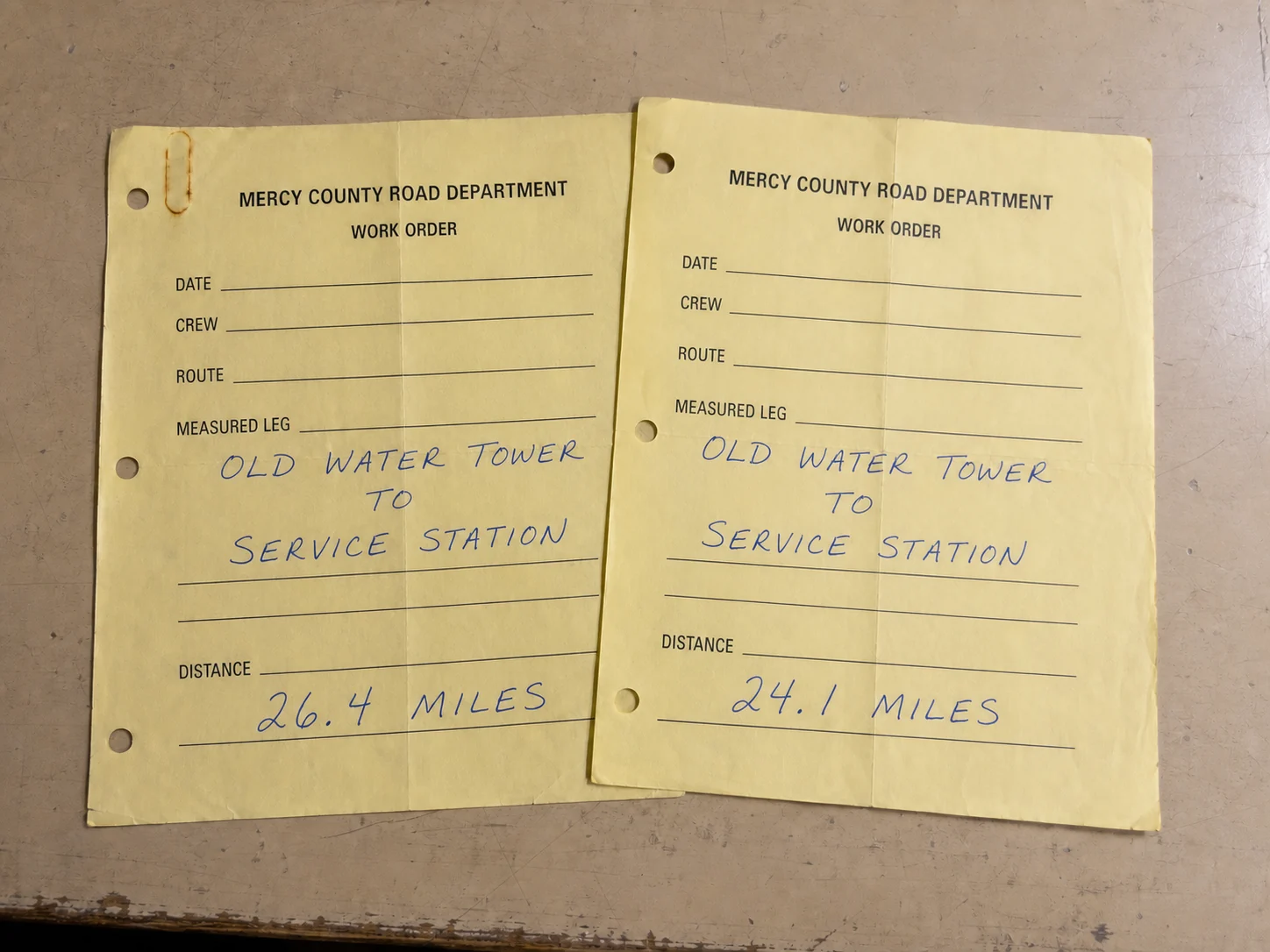
Two carbon-copy work orders record the same measured leg with different distance figures. Neither copy is marked as corrected.
Record details
- Measured leg
- Old Water Tower to service station
- First copy
- 26.4 miles
- Second copy
- 24.1 miles
- Correction notation
- None visible
Record description
The work orders use the same county form and the same handwritten description for the measured leg. Date and crew fields are blank on both copies.
The copies remain together in the work-order file under the same measured leg. Neither carries a correction, cancellation, or replacement notation.
Archive handling note
The papers were photographed together. Fold lines, hole punches, carbon transfer, and storage wear remain visible in the web image.
Archive handling note
- Source
- Mercy County Road Department work-order file
- Medium
- Two yellow carbon-copy work orders and archive photograph
- Record date
- Undated retained copies; web entry posted 08/25
For full-size maps, original paper, or a certified copy, contact the issuing office listed above.